Navy Meteorological Service extended its weather stations network along the coast
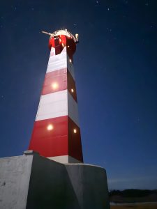
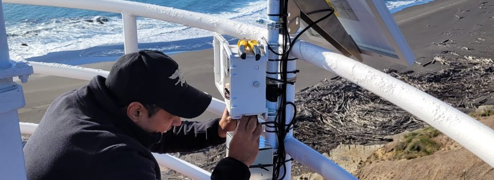
May 1st, 2024 During 2024 and within the framework of close collaboration with Fisheries Development Institute (IFOP), Navy Meteorological Service has installed two new automatic weather stations in Punta Ángeles lighthouses, in Valparaíso region and Punta Carranza, in Maule region.
Faced with a growing demand for meteorological data and to understand climatic change effects in Chile, the Navy Meteorological Service (SERVIMET), in cooperation with related institutions, has carried out initiatives aimed at extending the network of automatic meteorological stations along the coast. .
During 2024 and within the framework of close collaboration with the Fisheries Development Institute (IFOP), the Navy Meteorological Service has installed two new automatic weather stations in the Punta Ángeles lighthouses, in the region of Valparaíso and Punta Carranza, in the Maule region.
This instrumentation, provided by IFOP, will allow monitoring meteorological conditions at characteristic points of the central zone coastal sector, as part of Alert, Prediction and Observation System (S.A.P.O.) for fisheries resilience in a climatic change scenario, which It was implemented as part of “ Climatic Change Strengthening Adaptation in Chilean Fishing and Aquaculture Sector Capacity”, national project mandated by Fisheries and Aquaculture Undersecretariat.
For their part, Meteorological Center staff dependent on Valparaíso’s Maritime Government , carried out two automatic meteorological stations installation on “Valparaíso III” Floating Dock in collaboration with SOCIBER and at Recreational Yacht Club, with the purpose of having port city bay representative data.
Likewise, Cofradía Náutica del Pacífico Yacht Club, located in Algarrobo, joined the monitoring network, facilitating the meteorological station connection installed in its facilities next to the coastline.
In this way, Navy Meteorological Service website (meteoarmada.directemar.cl), has increased queries of data measured in real time, providing important support for planning and decision making, both for maritime users , as for the Local Maritime Authority.
With this shared data, we contribute to better risk management in the face of adverse weather conditions and make obtained records useful for technical, scientific and student institutions. Also, by providing more information that is more understandable when studying climate and its changes, adjusting to the demands of an increasingly globalized world.
news source: Chilean Navy
